|
Mapped valleys
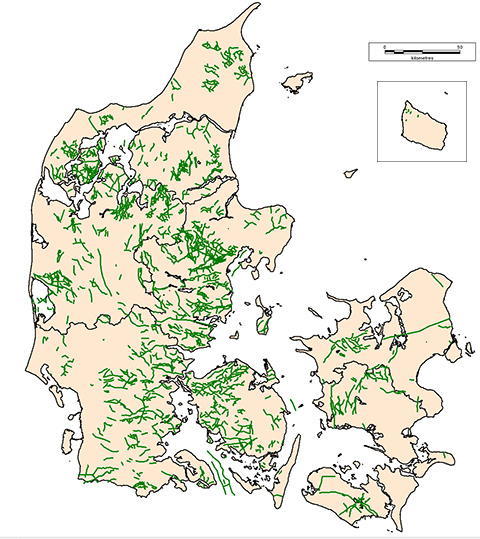
More than 5,600 km
of buried valleys at 281 localities have presently been mapped in Denmark. The
highest valley density is found in areas where TEM data have
been collected in dense grids and where the conditions for the
chosen mapping methods are ideal. Although many buried valleys have
been mapped in these areas, even more valleys are expected to
exist. The reason for this is that not all valleys can be mapped with the used methods because of limited size or contrasts to the surrounding sediments,
and because only parts of the onshore area has been mapped.
Despite the high degree of mapping activity in Denmark only around half of the country has been surveyed with the TEM method at the end of 2021.
Therefore only a part of all buried valleys in Denmark is
mapped. The number of mapped buried valleys is therefore to be regarded as a minimum and the map of mapped valleys will not reflect the true distribution and density of
buried valleys in Denmark.
However, the mapped valleys show
signs of a preferred geographical distribution. The valley
density seems to be lower in areas dominated by hydraulically
conductive sediments compared to areas dominated by impermeable
sediments. The hydraulic conditions of the subsurface sediments
are therefore expected to influence the valley formation.
Mapping reports
A number of reports have been made during the buried valley mapping project and all of these can be downloaded from the Download page. All of these reports are in Danish. The latest update of 2021 is exclusively a web-update.
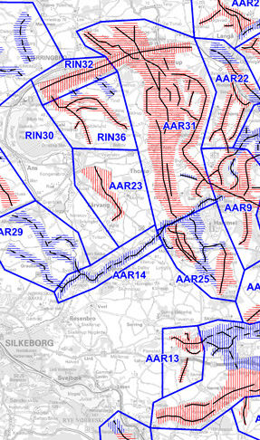
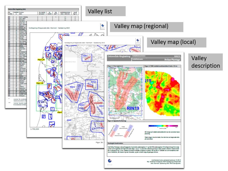
The latest physical report from 2015 has two volumes where Vol. 1 is the main report summarising the mapping project and Vol. 2 is a collection of descriptions of the mapped buried valleys at the 265 localities. Vol. 2 includes valley lists, regional and local valley maps and the individual valley descriptions. On this web site maps and valley descriptions can be found at the page named Kortlagte dale.
In addition to the reports a number of papers in English have also been made and a list of references can also be found on the Download page.
|